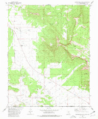
1980 Map of Smithsonian Butte
USGS Topo · Published 1981About this map
Smithsonian Butte rises prominently above a landscape defined by the towering Vermilion Cliffs and the elevated plateau of Canaan Mountain. This 1980 survey captures a period of remote ranching and grazing activity along the Utah Arizona border, where the terrain transitions from the open expanse of the Big Plain into the intricate drainage systems of Canaan Wash and Gould Wash. The map documents essential water sources in this arid environment, including Sawmill Spring and Canaan Springs, which were vital for local livestock operations like the Canaan Ranch. Transportation is represented by a few primary routes meeting at Big Plain Junction and a traditional Pack Trail winding through the cliffs. This topographical record provides a clear look at the geological barriers of Dutton Pass and the Canaan Gap that shaped movement through Washington County before modern development.
Find a feature on this map
24 named features on this map. Tap any name to fly to it.
Don’t see what you’re looking for? This feature index may not catch every label — zoom into the map to look around manually.
Map Details
Editions of this 1980 Smithsonian Butte Map
2 editions found
Other maps of this area

1885 · St. George
USGS Topo · 1:250,000

1886 · Kanab
USGS Topo · 1:250,000

1886 · Mt. Trumbull
USGS Topo · 1:250,000

1886 · Kaibab
USGS Topo · 1:250,000

1891 · St. George
USGS Topo · 1:250,000

1892 · Mt. Trumbull
USGS Topo · 1:250,000

1953 · Cedar City
USGS Topo · 1:250,000

1953 · Grand Canyon
USGS Topo · 1:250,000

1954 · La Verkin 4 SE
USGS Topo · 1:24,000

1954 · La Verkin 4 NW
USGS Topo · 1:24,000