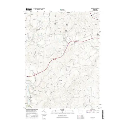
2016 Map of Smithton
USGS Topo · Published 2016About this map
The Youghiogheny River flows through the southwestern corner of this Westmoreland County region, anchoring a landscape shaped by coal-era settlements and creek-side industry. Small communities such as Hutchinson, Wyano, and Yukon dot the terrain, linked by a network of rural roads that follows the winding paths of Sewickley Creek and its tributaries. For those tracing family histories, numerous burial sites are preserved here, including Saint Timothys Cem and Milbell Cem. The geography transitions from the river lowlands near Jacobs Creek and Van Meter to the higher ground of Bald Hill, revealing the local dependence on both waterway access and hilltop vantage points. The presence of the Fresh Water Supply Pond and Lake Denise further illustrates the management of local water resources in a region characterized by historic mining and residential development.
Find a feature on this map
153 named features on this map. Tap any name to fly to it.
Don’t see what you’re looking for? This feature index may not catch every label — zoom into the map to look around manually.
Map Details
Editions of this 2016 Smithton Map
This is the sole edition of this map. No revisions or reprints were ever made.
Other maps of this area

1902 · Brownsville
USGS Topo · 1:62,500

1902 · Connellsville
USGS Topo · 1:62,500

1904 · Mc Keesport
USGS Topo · 1:62,500

1904 · Greensburg
USGS Topo · 1:62,500

1906 · Brownsville
USGS Topo · 1:62,500

1906 · Greensburg
USGS Topo · 1:62,500

1907 · Pittsburg
USGS Topo · 1:62,500

1931 · Brownsville
USGS Topo · 1:62,500

1931 · Connellsville
USGS Topo · 1:62,500

1933 · Brownsville
USGS Topo · 1:62,500