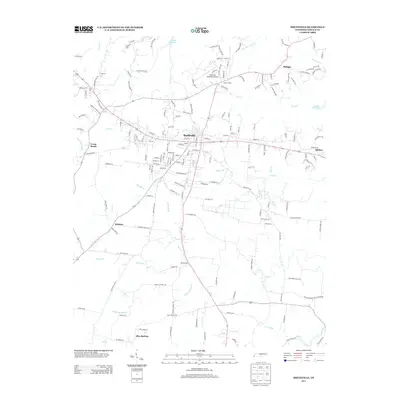
2013 Map of Smithville
USGS Topo · Published 2013About this map
The county seat of Smithville serves as the hub of this 2013 survey, where several major local routes converge amid the undulating landscape of Middle Tennessee. The map illustrates a detailed network of family-named roads such as Jacobs Pillar Rd and Lonnie Cantrell Rd, which connect the outlying communities of Philippi, Midway, and Blue Springs. To the north, the waters of Center Hill Lake reach into the terrain, fed by numerous tributaries including Eagle Creek and Fall Creek. A unique geological landmark, Cul-car-mac Falls, is noted along Fall Creek, while Shining Rock stands out as a distinctive terrain feature near the southern crossing of Pine Creek. Aviation infrastructure is represented by the Smithville Municipal Airport, located just north of the town center near Allens Chapel. The map effectively documents the transition from the structured street grid of the town to the more organic settlement patterns of the surrounding DeKalb County countryside.
Find a feature on this map
164 named features on this map. Tap any name to fly to it.
Don’t see what you’re looking for? This feature index may not catch every label — zoom into the map to look around manually.
Map Details
Editions of this 2013 Smithville Map
This is the sole edition of this map. No revisions or reprints were ever made.
Other maps of this area

1893 · Mc Minnville
USGS Topo · 1:125,000

1895 · Mc Minnville
USGS Topo · 1:125,000

1928 · Gordonsville
USGS Topo · 1:62,500

1942 · Statesville
USGS Topo · 1:100,000

1943 · Cookeville
USGS Topo · 1:100,000

1944 · Cookeville
USGS Topo · 1:100,000

1953 · Chattanooga
USGS Topo · 1:250,000

1956 · Silver Point
USGS Topo · 1:24,000

1956 · Corbin
USGS Topo · 1:250,000

1957 · Chattanooga
USGS Topo · 1:250,000