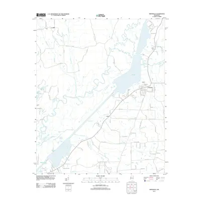
2012 Map of Smithville
USGS Topo · Published 2012About this map
Pool B and the Tombigbee River corridor dominate this landscape in northeast Mississippi during the early twenty-first century. The town of Smithville sits on the eastern bank of the waterway, serving as a focal point for the surrounding rural communities of Flinn and Carolina. The infrastructure of the area is defined by a dense network of country roads and local streets, such as Industrial St and Parkview Dr, reflecting the growth of the town away from the river’s edge.
Find a feature on this map
112 named features on this map. Tap any name to fly to it.
Don’t see what you’re looking for? This feature index may not catch every label — zoom into the map to look around manually.
Map Details
Editions of this 2012 Smithville Map
This is the sole edition of this map. No revisions or reprints were ever made.
Other maps of this area

1953 · West Point
USGS Topo · 1:250,000

1956 · Tupelo
USGS Topo · 1:250,000

1958 · Tupelo
USGS Topo · 1:250,000

1958 · West Point
USGS Topo · 1:250,000

1963 · West Point
USGS Topo · 1:250,000

1966 · Smithville
USGS Topo · 1:24,000

1966 · Beans Ferry
USGS Topo · 1:24,000

1966 · Amory
USGS Topo · 1:24,000

1966 · Turon
USGS Topo · 1:24,000

1966 · Wren
USGS Topo · 1:24,000