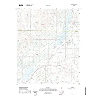
2018 Map of Smithville
USGS Topo · Published 2018About this map
The Tombigbee River corridor dominates the landscape of this Mississippi region, where the river's path is flanked by extensive wetlands and tributary networks including Bull Mountain Creek and Boguefala Creek. In the eastern section, the town of Smithville serves as a local hub, situated near the expansive waters of Pool B and Blue Water Cr. The map reveals a settlement pattern influenced by both the river and a web of rural roads such as Old Carolina Rd and Parham Store Rd. Toward the south, the northern reaches of Amory appear, including the residential developments of Sherwood Cove. Genealogists and local historians will find several burial grounds noted, such as New Chapel Cem and Dunlap Cem, alongside smaller settlements like Carolina and Flinn. This survey illustrates the modern intersection of water management and traditional rural communities in Monroe and Itawamba counties.
Find a feature on this map
67 named features on this map. Tap any name to fly to it.
Don’t see what you’re looking for? This feature index may not catch every label — zoom into the map to look around manually.
Map Details
Editions of this 2018 Smithville Map
This is the sole edition of this map. No revisions or reprints were ever made.
Other maps of this area

1953 · West Point
USGS Topo · 1:250,000

1956 · Tupelo
USGS Topo · 1:250,000

1958 · Tupelo
USGS Topo · 1:250,000

1958 · West Point
USGS Topo · 1:250,000

1963 · West Point
USGS Topo · 1:250,000

1966 · Smithville
USGS Topo · 1:24,000

1966 · Beans Ferry
USGS Topo · 1:24,000

1966 · Amory
USGS Topo · 1:24,000

1966 · Turon
USGS Topo · 1:24,000

1966 · Wren
USGS Topo · 1:24,000