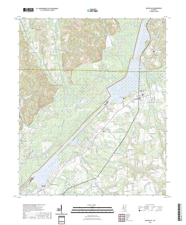
2024 Map of Smithville
USGS Topo · Published 2024About this map
Smithville and the surrounding borderlands of Itawamba and Monroe Counties are defined by the significant engineering of the Tennessee-Tombigbee Waterway. The river landscape includes Pool B and the original course of the Tombigbee River, creating a complex network of wetlands and channels like Blue Water Creek and Caldwell Branch. The map records several small settlements and crossroads, including Carolina to the northwest and the small community of Flinn south of the main waterway. Local genealogy is well-supported by the inclusion of numerous burial grounds such as Conwill Cem, New Chapel CME Cem, and Dunlap Cem. The southern edge of the sheet captures the outskirts of Amory, showing its proximity to Malone Lake and Burketts Creek. This layout illustrates the modern balance between heavy water infrastructure and traditional rural Mississippi settlements.
Find a feature on this map
110 named features on this map. Tap any name to fly to it.
Don’t see what you’re looking for? This feature index may not catch every label — zoom into the map to look around manually.
Map Details
Editions of this 2024 Smithville Map
This is the sole edition of this map. No revisions or reprints were ever made.
Other maps of this area

1953 · West Point
USGS Topo · 1:250,000

1956 · Tupelo
USGS Topo · 1:250,000

1958 · Tupelo
USGS Topo · 1:250,000

1958 · West Point
USGS Topo · 1:250,000

1963 · West Point
USGS Topo · 1:250,000

1966 · Smithville
USGS Topo · 1:24,000

1966 · Beans Ferry
USGS Topo · 1:24,000

1966 · Amory
USGS Topo · 1:24,000

1966 · Turon
USGS Topo · 1:24,000

1966 · Wren
USGS Topo · 1:24,000