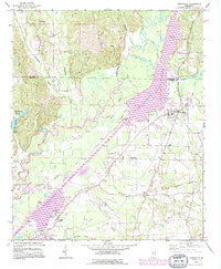
1992 Map of Smithville
USGS Topo · Published 1995About this map
The Tennessee-Tombigbee Waterway dominates the central corridor of this landscape, cutting a wide path through Monroe County and Itawamba County. This 1990s revision reveals the significant industrial and navigational infrastructure of the era, including Lock A, Lock B, and the Four Mile Creek Gas Field. The waterway's presence provides a stark contrast to the original winding course of the Tombigbee River, which meanders nearby along Standifer Island.
Find a feature on this map
45 named features on this map. Tap any name to fly to it.
Don’t see what you’re looking for? This feature index may not catch every label — zoom into the map to look around manually.
Map Details
Editions of this 1992 Smithville Map
This is the sole edition of this map. No revisions or reprints were ever made.
Other maps of this area

1953 · West Point
USGS Topo · 1:250,000

1956 · Tupelo
USGS Topo · 1:250,000

1958 · Tupelo
USGS Topo · 1:250,000

1958 · West Point
USGS Topo · 1:250,000

1963 · West Point
USGS Topo · 1:250,000

1966 · Smithville
USGS Topo · 1:24,000

1966 · Beans Ferry
USGS Topo · 1:24,000

1966 · Amory
USGS Topo · 1:24,000

1966 · Turon
USGS Topo · 1:24,000

1966 · Wren
USGS Topo · 1:24,000