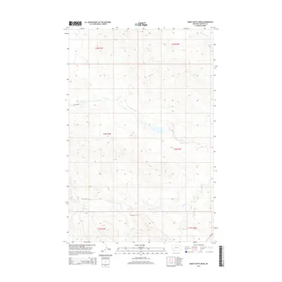
2014 Map of Smoky Butte Creek
USGS Topo · Published 2014About this map
Smoky Butte Cr and Lone Tree Cr drain the central portions of this Garfield County landscape, illustrating a classic Montana drainage pattern of ephemeral and perennial streams. The terrain is marked by the distinct branching of N Fork Lone Tree Cr and the more southern Steve Forks, which cut through the high plains topography. Sparse infrastructure defines the human presence in this area, concentrated primarily along unpaved routes like Lone Tree Rd E and Steves Fork Rd. In the southeastern corner, the presence of MT-200 provides a modern transit link across the more significant Big Dry Cr basin. This 2014 survey records the precise Public Land Survey System boundaries, including the intersection of t18n r35e and t18n r36e, reflecting the enduring grid of Western land management.
Find a feature on this map
14 named features on this map. Tap any name to fly to it.
Don’t see what you’re looking for? This feature index may not catch every label — zoom into the map to look around manually.
Map Details
Editions of this 2014 Smoky Butte Creek Map
This is the sole edition of this map. No revisions or reprints were ever made.
Other maps of this area

1954 · Jordan
USGS Topo · 1:250,000

1956 · Jordan
USGS Topo · 1:250,000

1958 · Jordan
USGS Topo · 1:250,000

1964 · Jordan
USGS Topo · 1:250,000

1965 · Big Dry School
USGS Topo · 1:24,000

1965 · Edwards
USGS Topo · 1:24,000

1965 · Ziegele Coulee
USGS Topo · 1:24,000
1983 · Biscuit Butte
USGS Topo · 1:24,000

1983 · Steve Forks
USGS Topo · 1:24,000
1983 · Smoky Butte
USGS Topo · 1:24,000