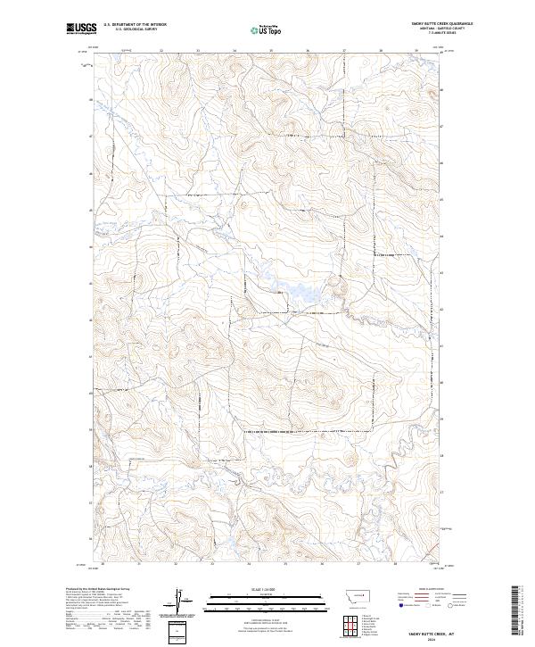
2024 Map of Smoky Butte Creek
USGS Topo · Published 2024About this map
Big Dry Creek meanders across the southeastern corner of this Garfield County landscape, joined by a network of drainage systems that define the area's physical character. The terrain is structured by the seasonal flows of Smoky Butte Creek, Lone Tree Creek, and North Fork Lone Tree Creek, which cut through the high plains of Eastern Montana. This modern U.S. Geological Survey representation tracks the rural infrastructure of the early 21st century, where access is provided by a few established routes such as Lone Tree Rd and Steve's Fork Rd. The map provides a clear look at the Public Land Survey System grid, including the intersection of t18n r36e and surrounding townships, which remains the primary method for tracking land ownership and grazing rights in this open ranching country. The presence of Steve Forks in the southern portion suggests the continued importance of specific water sources in an otherwise arid environment.
Find a feature on this map
13 named features on this map. Tap any name to fly to it.
Don’t see what you’re looking for? This feature index may not catch every label — zoom into the map to look around manually.
Map Details
Editions of this 2024 Smoky Butte Creek Map
This is the sole edition of this map. No revisions or reprints were ever made.
Other maps of this area

1954 · Jordan
USGS Topo · 1:250,000

1956 · Jordan
USGS Topo · 1:250,000

1958 · Jordan
USGS Topo · 1:250,000

1964 · Jordan
USGS Topo · 1:250,000

1965 · Big Dry School
USGS Topo · 1:24,000

1965 · Edwards
USGS Topo · 1:24,000

1965 · Ziegele Coulee
USGS Topo · 1:24,000
1983 · Biscuit Butte
USGS Topo · 1:24,000

1983 · Steve Forks
USGS Topo · 1:24,000
1983 · Smoky Butte
USGS Topo · 1:24,000