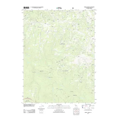
2012 Map of Smoky Creek
USGS Topo · Published 2012About this map
S Fork Trinity River carves through this Trinity County landscape, creating a network of deep drainages and high meadows during the early 2010s. The area is defined by its isolation and its connection to the timber and ranching history of Northern California, marked by small settlements and family-named landmarks like Murphy Place and Bramlet Place. The terrain rises toward Red Mountain in the east, with a complex system of Forest Service routes like Forest Rte 28N30 and Bramlet Rd providing the only access to remote points such as Foss Camp.
Find a feature on this map
35 named features on this map. Tap any name to fly to it.
Don’t see what you’re looking for? This feature index may not catch every label — zoom into the map to look around manually.
Map Details
Editions of this 2012 Smoky Creek Map
This is the sole edition of this map. No revisions or reprints were ever made.
Other maps of this area

1918 · Anada
USGS Topo · 1:62,500

1921 · Hoaglin
USGS Topo · 1:62,500

1922 · Island Mountain
USGS Topo · 1:62,500

1931 · Hoaglin
USGS Topo · 1:96,000

1935 · Hoaglin
USGS Topo · 1:125,000

1953 · Blackrock Mtn
USGS Topo · 1:62,500

1954 · Pickett Peak
USGS Topo · 1:62,500

1954 · Dubakella Mtn
USGS Topo · 1:62,500

1954 · Blackrock Mtn
USGS Topo · 1:62,500
1955 · Kettenpom
USGS Topo · 1:62,500