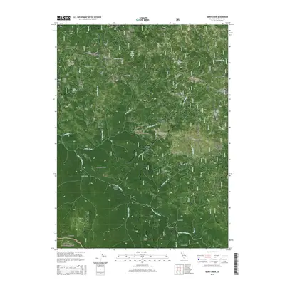
2015 Map of Smoky Creek
USGS Topo · Published 2015About this map
Murphy Place and Bramlet Place anchor this remote section of northern California, situated where the Trinity National Forest meets the Six Rivers National Forest. The landscape is defined by the steep drainage of the S Fork Trinity River, which is fed by numerous tributaries including Smoky Creek, Dubakella Cr, and Happy Camp Cr. The topographic detail reveals a network of high ridges and named gaps, such as Rattlesnake Ridge, Bierce Ridge, and Snow Gap. Forest service routes like Bramlet Rd and Forest Rte 29N58 provide the primary access through this complex terrain. The map illustrates a high-elevation environment where land use is marked by features like Red Mountain Pasture and isolated meadows such as Swim Meadow, reflecting the region's history of seasonal grazing and timber management.
Find a feature on this map
40 named features on this map. Tap any name to fly to it.
Don’t see what you’re looking for? This feature index may not catch every label — zoom into the map to look around manually.
Map Details
Editions of this 2015 Smoky Creek Map
This is the sole edition of this map. No revisions or reprints were ever made.
Other maps of this area

1918 · Anada
USGS Topo · 1:62,500

1921 · Hoaglin
USGS Topo · 1:62,500

1922 · Island Mountain
USGS Topo · 1:62,500

1931 · Hoaglin
USGS Topo · 1:96,000

1935 · Hoaglin
USGS Topo · 1:125,000

1953 · Blackrock Mtn
USGS Topo · 1:62,500

1954 · Pickett Peak
USGS Topo · 1:62,500

1954 · Dubakella Mtn
USGS Topo · 1:62,500

1954 · Blackrock Mtn
USGS Topo · 1:62,500
1955 · Kettenpom
USGS Topo · 1:62,500