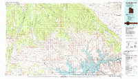
1985 Map of Smoky Mountain
USGS Topo · Published 1985About this map
Lake Powell dominates the southern landscape of this 1980s topographic study, illustrating the complex shoreline of the reservoir within the Glen Canyon National Recreation Area. The map details the intricate network of flooded canyons including Wahweap Bay, Padre Bay, and Last Chance Bay, which contrast sharply with the high, arid elevations of the Kaiparowits Plateau and Fiftymile Mountain.
Find a feature on this map
62 named features on this map. Tap any name to fly to it.
Don’t see what you’re looking for? This feature index may not catch every label — zoom into the map to look around manually.
Map Details
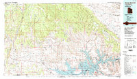
Editions of this 1985 Smoky Mountain Map
2 editions found
Other maps of this area

1883 · Marsh Pass
USGS Topo · 1:250,000

1886 · Kanab
USGS Topo · 1:250,000

1886 · Escalante
USGS Topo · 1:250,000

1886 · Henry Mountains
USGS Topo · 1:250,000

1886 · Echo Cliffs
USGS Topo · 1:250,000

1886 · Kaibab
USGS Topo · 1:250,000

1891 · Echo Cliffs
USGS Topo · 1:250,000

1892 · Marsh Pass
USGS Topo · 1:250,000

1892 · Henry Mountains
USGS Topo · 1:250,000

1922 · Warm Creek
USGS Topo · 1:63,360