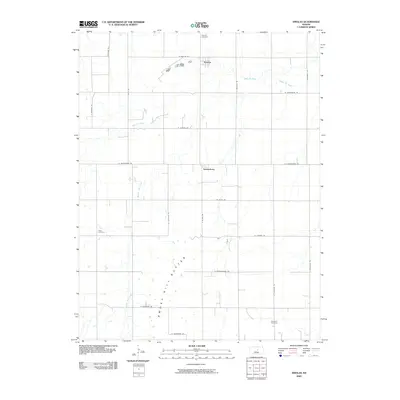
2009 Map of Smolan
USGS Topo · Published 2009About this map
The small agricultural community of Smolan anchors this 2009 survey of the central Kansas prairie. The landscape is defined by the Smoky Hill Buttes, a prominent series of uplands that break the surrounding drainage patterns of West Dry Creek and Middle Dry Creek. A grid of section roads, including W Salemsborg Rd and Centennial Rd, reflects the deep history of rural land division in Saline County. Historically significant sites for genealogists include the Salemsborg settlement and three distinct burial grounds: Smolan Cemetery in the north, Falun Cemetery to the west, and Rose Hill Cemetery in the southeast. This map illustrates how the local road network persists around these long-standing community centers and the natural contours of the buttes.
Find a feature on this map
26 named features on this map. Tap any name to fly to it.
Don’t see what you’re looking for? This feature index may not catch every label — zoom into the map to look around manually.
Map Details
Editions of this 2009 Smolan Map
This is the sole edition of this map. No revisions or reprints were ever made.
Other maps of this area

1892 · Salina
USGS Topo · 1:125,000

1942 · Salina
USGS Topo · 1:125,000

1955 · Salina
USGS Topo · 1:24,000

1955 · Assaria
USGS Topo · 1:24,000

1955 · Salina SW
USGS Topo · 1:24,000

1955 · Smolan
USGS Topo · 1:24,000

1955 · Brookville
USGS Topo · 1:24,000

1955 · Falun
USGS Topo · 1:24,000

1955 · Hutchinson
USGS Topo · 1:250,000

1959 · Hutchinson
USGS Topo · 1:250,000