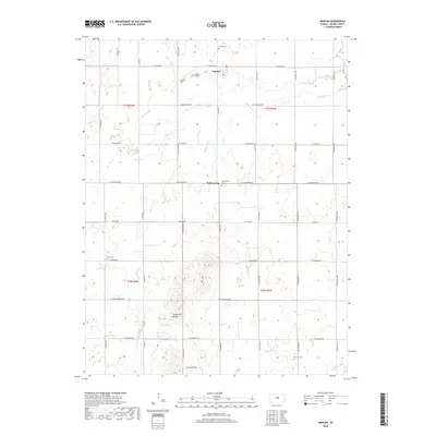
2018 Map of Smolan
USGS Topo · Published 2018About this map
Smolan and Salemsborg anchor this Saline County landscape, where the agricultural grid is defined by a dense network of country roads including W Smolan Rd and S Burma Rd. The terrain is shaped by the drainage of W Dry Cr and Middle Dry Cr, which weave through the section lines toward the more prominent Smoky Hill Buttes in the southern portion of the quadrangle. For those researching local families, the map is particularly valuable for its precise location of multiple burial grounds, such as Smolan Cem, Salemsborg Cem, Falun Cem, and Rose Hill Cem, which sit alongside the township's primary intersections. The area's settlement pattern reflects a deeply rooted rural community, where the placement of small-town centers and cemeteries among the surrounding farms has remained largely consistent since the early 20th century.
Find a feature on this map
31 named features on this map. Tap any name to fly to it.
Don’t see what you’re looking for? This feature index may not catch every label — zoom into the map to look around manually.
Map Details
Editions of this 2018 Smolan Map
This is the sole edition of this map. No revisions or reprints were ever made.
Other maps of this area

1892 · Salina
USGS Topo · 1:125,000

1942 · Salina
USGS Topo · 1:125,000

1955 · Salina
USGS Topo · 1:24,000

1955 · Assaria
USGS Topo · 1:24,000

1955 · Salina SW
USGS Topo · 1:24,000

1955 · Smolan
USGS Topo · 1:24,000

1955 · Brookville
USGS Topo · 1:24,000

1955 · Falun
USGS Topo · 1:24,000

1955 · Hutchinson
USGS Topo · 1:250,000

1959 · Hutchinson
USGS Topo · 1:250,000