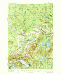
1937 Map of Smyrna Mills
USGS Topo · Published 1937About this map
The Bangor and Aroostook railroad defines the industrial geography of this 1930s Aroostook County landscape, connecting timber and agricultural hubs like Smyrna Mills and Oakfield. The region is a network of ridges and water bodies, with local life centered around rural institutions such as the Roach Sch and Hall Sch. The surveyor R.E. Amidon captured a transition in cartography here, utilizing aerial photographs from the Army Air Corps to supplement traditional ground control.
Find a feature on this map
124 named features on this map. Tap any name to fly to it.
Don’t see what you’re looking for? This feature index may not catch every label — zoom into the map to look around manually.
Map Details
Editions of this 1937 Smyrna Mills Map
3 editions found
Other maps of this area

1934 · Bridgewater
USGS Topo · 1:48,000

1935 · Howe Brook
USGS Topo · 1:48,000

1937 · Smyrna Mills
USGS Topo · 1:62,500

1938 · Bridgewater
USGS Topo · 1:62,500

1938 · Houlton
USGS Topo · 1:62,500

1939 · Howe Brook
USGS Topo · 1:62,500

1940 · Amity
USGS Topo · 1:62,500

1940 · Island Falls
USGS Topo · 1:62,500

1940 · Sherman
USGS Topo · 1:62,500

1940 · Oxbow
USGS Topo · 1:62,500