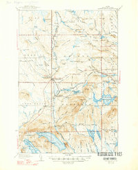
1937 Map of Smyrna Mills
USGS Topo · Published 1947About this map
The Bangor and Aroostook railroad defines the industrial and social geometry of this Aroostook County landscape, connecting the lumber and farming hubs of Smyrna Mills and Oakfield. These settlements emerged as vital collection points for the region's timber and agricultural output, supported by local infrastructure like the Hunt Mill and a network of rural schools including Roach Sch, Marley Sch, and Longfellow Sch.
Find a feature on this map
146 named features on this map. Tap any name to fly to it.
Don’t see what you’re looking for? This feature index may not catch every label — zoom into the map to look around manually.
Map Details
Editions of this 1937 Smyrna Mills Map
3 editions found
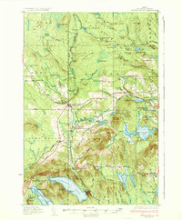
Other maps of this area

1934 · Bridgewater
USGS Topo · 1:48,000

1935 · Howe Brook
USGS Topo · 1:48,000

1937 · Smyrna Mills
USGS Topo · 1:62,500

1938 · Bridgewater
USGS Topo · 1:62,500

1938 · Houlton
USGS Topo · 1:62,500

1939 · Howe Brook
USGS Topo · 1:62,500

1940 · Amity
USGS Topo · 1:62,500

1940 · Island Falls
USGS Topo · 1:62,500

1940 · Sherman
USGS Topo · 1:62,500

1940 · Oxbow
USGS Topo · 1:62,500