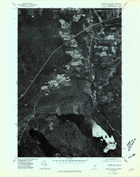
1975 Map of Smyrna Mills SW
USGS Topo · Published 1980About this map
Oakfield and the surrounding timberlands of southern Aroostook County are captured in this mid-1970s orthophotograph, where the clearing patterns for agriculture and logging are clearly visible against the heavy forest cover. The settlement of Dyer Brook sits at a crossroads west of the East Branch Mattawamkeag, a waterway that defined the early industrial and transport history of this region. To the south, the clear waters of Pleasant Lake dominate the lower landscape, bounded by the elevated terrain of De Lette Ridge. This specific survey emphasizes the land-use transitions of the era, from the established small community at Red Bridge to the emerging interstate highway corridor that began to bypass the traditional town centers of the Maine woods.
Find a feature on this map
6 named features on this map. Tap any name to fly to it.
Don’t see what you’re looking for? This feature index may not catch every label — zoom into the map to look around manually.
Map Details
Editions of this 1975 Smyrna Mills SW Map
This is the sole edition of this map. No revisions or reprints were ever made.
Other maps of this area

1937 · Smyrna Mills
USGS Topo · 1:62,500

1940 · Island Falls
USGS Topo · 1:62,500

1940 · Sherman
USGS Topo · 1:62,500

1941 · Mattawamkeag Lake
USGS Topo · 1:62,500

1942 · Island Falls
USGS Topo · 1:62,500

1942 · Sherman
USGS Topo · 1:62,500

1943 · Mattawamkeag Lake
USGS Topo · 1:62,500

1954 · Presque Isle
USGS Topo · 1:250,000

1954 · Millinocket
USGS Topo · 1:250,000

1955 · Smyrna Mills
USGS Topo · 1:62,500