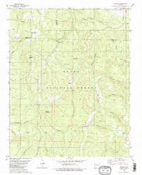
1980 Map of Smyrna
USGS Topo · Published 1980About this map
Smyrna and the surrounding highlands of the Ozark National Forest are defined by a complex network of deep hollows and timbered ridges at the intersection of Pope, Newton, and Searcy counties. Small settlements like Ben Hur, Raspberry, and Nogo are linked by primitive roads following the high ground of Divide Mountain or the valleys of the Illinois Bayou and the Middle Fork. Genealogists and local historians will find significant data points in the numerous burial grounds and religious sites, including the Old Smyrna Cem, Nogo Cem, and the Smyrna Ch. The landscape is heavily dissected by named drainages such as Falling Water Creek, Cedar Creek, and Raspberry Creek, illustrating the remote and traditional settlement patterns of the Arkansas Ozarks in the mid-1970s. The presence of features like Mill Hollow and Graveyard Hollow speaks to the historical land use and early community landmarks of this interior forest region.
Find a feature on this map
35 named features on this map. Tap any name to fly to it.
Don’t see what you’re looking for? This feature index may not catch every label — zoom into the map to look around manually.
Map Details
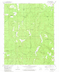
Editions of this 1980 Smyrna Map
2 editions found
Other maps of this area

1879 · Washington
USGS Topo · 1:62,500

1887 · Smyrna
USGS Topo · 1:62,500

1889 · Treat
USGS Topo · 1:62,500

1889 · Marshall #3
USGS Topo · 1:62,500

1892 · Marshall
USGS Topo · 1:125,000

1894 · Marshall
USGS Topo · 1:125,000

1901 · Marshall
USGS Topo · 1:125,000

1932 · Treat
USGS Topo · 1:62,500

1933 · Mt Judea
USGS Topo · 1:62,500

1934 · Treat
USGS Topo · 1:62,500