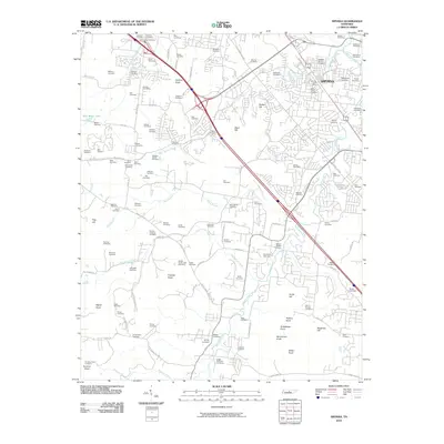
2010 Map of Smyrna
USGS Topo · Published 2010About this map
The Smyrna landscape is defined by a dense concentration of family burial grounds and historical landmarks, reflecting centuries of settlement along the waterways of Middle Tennessee. The town center is anchored by the Smyrna Post Office, while the surrounding terrain is marked by prominent elevations such as Prewitts Knob, Signal Knob, and Grindstone Knob. The distribution of dozens of small cemeteries, including the Sam Davis Cemetery, Hill-Roulhac Cemetery, and the White-Lowry Cemetery, provides a detailed record of the families who established homesteads across this region. Waterways like Stewart Creek and Rock Spring Branch provided the essential drainage and resource network for these early communities. The map also traces the modern infrastructure of the area, showing how roads like the Old Nashville Hwy and Burkitt Rd follow the historic paths through the knobs and creek valleys.
Find a feature on this map
119 named features on this map. Tap any name to fly to it.
Don’t see what you’re looking for? This feature index may not catch every label — zoom into the map to look around manually.
Map Details
Editions of this 2010 Smyrna Map
This is the sole edition of this map. No revisions or reprints were ever made.
Other maps of this area

1903 · Nashville
USGS Topo · 1:125,000

1916 · Murfreesboro
USGS Topo · 1:62,500

1932 · Hermitage
USGS Topo · 1:62,500

1942 · Lebanon
USGS Topo · 1:100,000

1950 · Walterhill
USGS Topo · 1:24,000

1950 · Murfreesboro
USGS Topo · 1:24,000

1952 · La Vergne
USGS Topo · 1:24,000

1952 · Antioch
USGS Topo · 1:24,000

1956 · Gladeville
USGS Topo · 1:24,000

1956 · Columbia
USGS Topo · 1:250,000