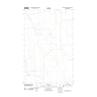
2011 Map of Snake Creek School
USGS Topo · Published 2011About this map
Snake Creek School (Historical) stands as a primary point of interest in this rural Montana landscape, marking the site of a community center long since moved into history. The terrain is defined by a dendritic network of drainages, where Crow Creek and its tributary East Fork Crow Creek carve through the plains. Local connectivity is maintained by a series of graded routes such as Hinsdale N Rd and Duncan Rd, which navigate the subtle rises between watercourses. Smaller features like Tiny Spring provide evidence of localized water sources vital to the area's agricultural life. The persistence of these names on the landscape, including Ichpair Creek and Snake Creek, offers a clear view of the region's hydrography and early settlement patterns in Valley County.
Find a feature on this map
12 named features on this map. Tap any name to fly to it.
Don’t see what you’re looking for? This feature index may not catch every label — zoom into the map to look around manually.
Map Details
Editions of this 2011 Snake Creek School Map
This is the sole edition of this map. No revisions or reprints were ever made.
Other maps of this area

1919 · Boundary
USGS Topo · 1:125,000

1954 · Glasgow
USGS Topo · 1:250,000

1957 · Glasgow
USGS Topo · 1:250,000

1958 · Glasgow
USGS Topo · 1:250,000

1984 · Snake Creek School
USGS Topo · 1:24,000

1984 · Black Calf Reservoir
USGS Topo · 1:24,000

1984 · Opheim
USGS Topo · 1:100,000

1984 · Coulter Coulee
USGS Topo · 1:24,000

1984 · Crow Creek Dam
USGS Topo · 1:24,000
1984 · Burnett Creek
USGS Topo · 1:24,000