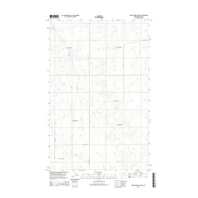
2014 Map of Snake Creek School
USGS Topo · Published 2014About this map
Snake Creek School stands as a focal point in this remote section of Valley County, Montana, providing a landmark in an area defined by its drainage basins and rural road network. The landscape is carved by the intermittent waters of E Fork Crow Cr and Ichpair Cr, which run through the eastern townships. Further south and west, the namesake Snake Cr and the uniquely named Tiny Spring offer notable water sources in this high plains environment.
Find a feature on this map
15 named features on this map. Tap any name to fly to it.
Don’t see what you’re looking for? This feature index may not catch every label — zoom into the map to look around manually.
Map Details
Editions of this 2014 Snake Creek School Map
This is the sole edition of this map. No revisions or reprints were ever made.
Other maps of this area

1919 · Boundary
USGS Topo · 1:125,000

1954 · Glasgow
USGS Topo · 1:250,000

1957 · Glasgow
USGS Topo · 1:250,000

1958 · Glasgow
USGS Topo · 1:250,000

1984 · Snake Creek School
USGS Topo · 1:24,000

1984 · Black Calf Reservoir
USGS Topo · 1:24,000

1984 · Opheim
USGS Topo · 1:100,000

1984 · Coulter Coulee
USGS Topo · 1:24,000

1984 · Crow Creek Dam
USGS Topo · 1:24,000
1984 · Burnett Creek
USGS Topo · 1:24,000