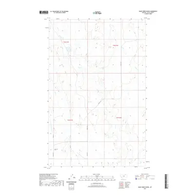
2020 Map of Snake Creek School
USGS Topo · Published 2020About this map
Snake Creek School anchors the southwestern corner of this Valley County landscape, a marker of the rural educational infrastructure in this expansive section of Montana. The area is defined by a dendritic network of drainage systems, most notably the meandering paths of Snake Cr and Crow Cr. These waterways, along with E Fork Crow Cr and the uniquely named Tiny Spring, dictate the local topography and have historically influenced the placement of early ranching and transport routes. Connectivity across this prairie terrain is maintained by a series of graded roads, including Hinsdale N Rd and Snake Cr Rd, which follow the natural contours of the stream valleys. The map provides a clear look at the township and range divisions, such as t36n r35e, which historically partitioned this land for settlement and grazing.
Find a feature on this map
15 named features on this map. Tap any name to fly to it.
Don’t see what you’re looking for? This feature index may not catch every label — zoom into the map to look around manually.
Map Details
Editions of this 2020 Snake Creek School Map
This is the sole edition of this map. No revisions or reprints were ever made.
Other maps of this area

1919 · Boundary
USGS Topo · 1:125,000

1954 · Glasgow
USGS Topo · 1:250,000

1957 · Glasgow
USGS Topo · 1:250,000

1958 · Glasgow
USGS Topo · 1:250,000

1984 · Snake Creek School
USGS Topo · 1:24,000

1984 · Black Calf Reservoir
USGS Topo · 1:24,000

1984 · Opheim
USGS Topo · 1:100,000

1984 · Coulter Coulee
USGS Topo · 1:24,000

1984 · Crow Creek Dam
USGS Topo · 1:24,000
1984 · Burnett Creek
USGS Topo · 1:24,000