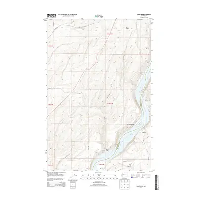
2013 Map of Snake River
USGS Topo · Published 2013About this map
The Snake River defines the border between Franklin and Walla Walla Counties, carving a deep path through the plateau landscape. This 2013 survey shows the river transformed into Lake Sacajawea, with the Lake Sacajawea Bar visible near the river bends. Small settlements and railroad-related points such as Burr, Walker, and Sheffler line the eastern banks, while Snake River Junction and Simmons occupy the western side. The topography is marked by significant drainages including Burr Canyon, Walker Canyon, and McCoy Canyon, which reveal the complex erosion patterns typical of this region. A network of rural roads like Moulton Rd and Snake River Rd connect the high ground to the water's edge, reflecting the enduring agricultural and transportation infrastructure of the Pacific Northwest river system.
Find a feature on this map
33 named features on this map. Tap any name to fly to it.
Don’t see what you’re looking for? This feature index may not catch every label — zoom into the map to look around manually.
Map Details
Editions of this 2013 Snake River Map
This is the sole edition of this map. No revisions or reprints were ever made.
Other maps of this area

1915 · Wallulah
USGS Topo · 1:96,000

1916 · Connell
USGS Topo · 1:125,000

1918 · Connell
USGS Topo · 1:125,000

1918 · Wallula
USGS Topo · 1:125,000

1953 · Walla Walla
USGS Topo · 1:250,000

1958 · Walla Walla
USGS Topo · 1:250,000

1964 · Levey SE
USGS Topo · 1:24,000

1964 · Levey NE
USGS Topo · 1:24,000

1966 · Page
USGS Topo · 1:24,000

1966 · Snake River
USGS Topo · 1:24,000