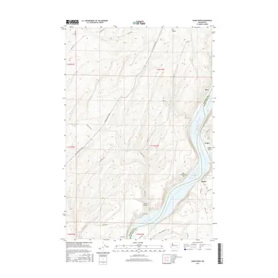
2017 Map of Snake River
USGS Topo · Published 2017About this map
Burr, Walker, and Sheffler sit along the high banks and coulees of the Snake River canyon, marking a landscape defined by sharp elevation changes between the river and the surrounding plateau. The 2017 terrain shows the expansive Lake Sacajawea, a reservoir formed by downstream damming, which dominates the eastern half of the map. Tracing the steep canyon walls, several significant topographical features are visible, including Burr Canyon and McCoy Canyon, where the elevation drops from over 1,300 feet to the water's edge below 600 feet. The road network, including the Pasco Kahlotus Road and Snake River Rd, follows the natural contours of the land, connecting these small settlements and geographic landmarks. On the western side of the river, Jones Spr provides a rare point of interest in the higher, drier country of the Franklin and Walla Walla county border region.
Find a feature on this map
30 named features on this map. Tap any name to fly to it.
Don’t see what you’re looking for? This feature index may not catch every label — zoom into the map to look around manually.
Map Details
Editions of this 2017 Snake River Map
This is the sole edition of this map. No revisions or reprints were ever made.
Other maps of this area

1915 · Wallulah
USGS Topo · 1:96,000

1916 · Connell
USGS Topo · 1:125,000

1918 · Connell
USGS Topo · 1:125,000

1918 · Wallula
USGS Topo · 1:125,000

1953 · Walla Walla
USGS Topo · 1:250,000

1958 · Walla Walla
USGS Topo · 1:250,000

1964 · Levey SE
USGS Topo · 1:24,000

1964 · Levey NE
USGS Topo · 1:24,000

1966 · Page
USGS Topo · 1:24,000

1966 · Snake River
USGS Topo · 1:24,000