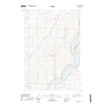
2020 Map of Snake River
USGS Topo · Published 2020About this map
Snake River geography dominates this modern survey of the border between Franklin and Walla Walla Counties. The map focuses on the impounded waters of Lake Sacajawea, a significant reach of the river where steep-sided terrain like Burr Canyon and McCoy Canyon meets the water's edge. This landscape reflects the modern management of the Columbia River Basin's waterways, where older river bars like Lake Sacajawea Bar are now part of a regulated reservoir system.
Find a feature on this map
34 named features on this map. Tap any name to fly to it.
Don’t see what you’re looking for? This feature index may not catch every label — zoom into the map to look around manually.
Map Details
Editions of this 2020 Snake River Map
This is the sole edition of this map. No revisions or reprints were ever made.
Other maps of this area

1915 · Wallulah
USGS Topo · 1:96,000

1916 · Connell
USGS Topo · 1:125,000

1918 · Connell
USGS Topo · 1:125,000

1918 · Wallula
USGS Topo · 1:125,000

1953 · Walla Walla
USGS Topo · 1:250,000

1958 · Walla Walla
USGS Topo · 1:250,000

1964 · Levey SE
USGS Topo · 1:24,000

1964 · Levey NE
USGS Topo · 1:24,000

1966 · Page
USGS Topo · 1:24,000

1966 · Snake River
USGS Topo · 1:24,000