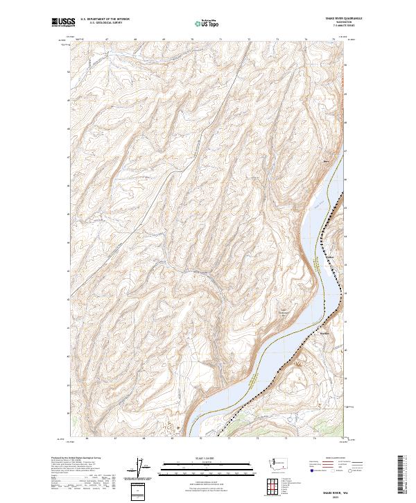
2023 Map of Snake River
USGS Topo · Published 2023About this map
Snake River geography dominates the eastern edge of this Franklin County landscape, where the water flows past the riverside communities of Burr, Walker, and Sheffler. The terrain is defined by a dense network of coulees and canyons, most notably McCoy Canyon, which cuts through the high ground west of the river. The Columbia Plateau State Park Trail follows a north-south corridor through the river valley, tracing a path through the same geography that once supported the region's early settlements. Transportation remains a mix of old routes and modern connectors, with Pasco Kahlotus Rd and Snake River Rd providing access to the river's edge. The presence of Lake Sacajawea Bar indicates the shifting nature of the river shoreline and the importance of these waterways to the local topography.
Find a feature on this map
29 named features on this map. Tap any name to fly to it.
Don’t see what you’re looking for? This feature index may not catch every label — zoom into the map to look around manually.
Map Details
Editions of this 2023 Snake River Map
This is the sole edition of this map. No revisions or reprints were ever made.
Other maps of this area

1915 · Wallulah
USGS Topo · 1:96,000

1916 · Connell
USGS Topo · 1:125,000

1918 · Connell
USGS Topo · 1:125,000

1918 · Wallula
USGS Topo · 1:125,000

1953 · Walla Walla
USGS Topo · 1:250,000

1958 · Walla Walla
USGS Topo · 1:250,000

1964 · Levey SE
USGS Topo · 1:24,000

1964 · Levey NE
USGS Topo · 1:24,000

1966 · Page
USGS Topo · 1:24,000

1966 · Snake River
USGS Topo · 1:24,000