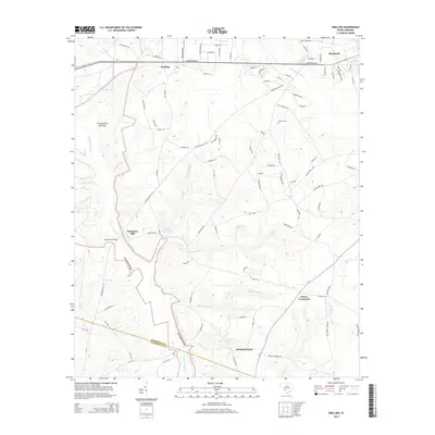
2014 Map of Snelling
USGS Topo · Published 2014About this map
The Savanna River landscape south of Barnwell is defined by a dense network of watercourses and early milling sites. Small settlements like Snelling and Owens Crossroad anchor the interior, while the transition between Barnwell Co and Allendale Co is marked by the shifting path of Lower Three Runs. Local history is preserved in landmarks such as Holmes Cem and Pattersons Bridge, which speaks to the rural transit patterns established long before modern paved routes. The presence of Hayes Mill Pond and Gantts Mill Cr highlights the region's historical reliance on smaller tributaries for local industry. Further south, the terrain descends toward Boiling Springs, where the namesake Boiling Spring serves as a prominent natural feature amidst the woodland and creek beds of Bodiford Mill Cr.
Find a feature on this map
96 named features on this map. Tap any name to fly to it.
Don’t see what you’re looking for? This feature index may not catch every label — zoom into the map to look around manually.
Map Details
Editions of this 2014 Snelling Map
This is the sole edition of this map. No revisions or reprints were ever made.
Other maps of this area

1919 · Allendale
USGS Topo · 1:62,500

1920 · Ellenton
USGS Topo · 1:48,000

1920 · Talatha
USGS Topo · 1:48,000

1921 · Talatha
USGS Topo · 1:62,500

1921 · Ellenton
USGS Topo · 1:62,500

1923 · Williston
USGS Topo · 1:48,000

1927 · Williston
USGS Topo · 1:62,500

1943 · Allendale
USGS Topo · 1:62,500

1943 · Augusta East
USGS Topo · 1:125,000

1943 · Williston
USGS Topo · 1:62,500