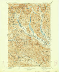
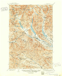
1903 Map of Snoqualmie
USGS Topo · Published 1923About this map
The Northern Pacific Railroad serves as the industrial spine of this Cascades landscape, engineering a path through the mountains via the Stampede Tunnel. This 1903 survey illustrates the early development of critical mountain passes and rail-side settlements like Lester, Stampede, and Easton. The map highlights a period before massive regional water management projects, showing the natural shorelines of Keechelus Lake and Kachess Lake before their later dam-driven expansions.
Find a feature on this map
133 named features on this map. Tap any name to fly to it.
Don’t see what you’re looking for? This feature index may not catch every label — zoom into the map to look around manually.
Map Details
Editions of this 1903 Snoqualmie Map
6 editions found
Other maps of this area

1897 · Mount Stuart
USGS Topo · 1:125,000

1899 · Ellensburg
USGS Topo · 1:125,000

1901 · Ellensburg
USGS Topo · 1:125,000

1901 · Chiwaukum
USGS Topo · 1:125,000

1901 · Snoqualmie Pass
USGS Topo · 1:125,000

1902 · Mount Aix
USGS Topo · 1:125,000

1902 · Skykomish
USGS Topo · 1:125,000

1902 · Mount Stuart
USGS Topo · 1:125,000

1903 · Snoqualmie
USGS Topo · 1:125,000

1904 · Mt Aix
USGS Topo · 1:125,000