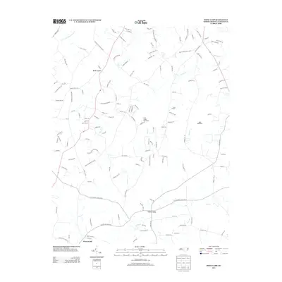
2013 Map of Snow Camp
USGS Topo · Published 2013About this map
Snow Camp serves as a central hub in this Southern Alamance County landscape, where the rural character is defined by a dense network of family-named roads and winding watercourses. The terrain is punctuated by the Cane Creek Mountains and Bass Mountain, which rise above the surrounding valleys carved by Cane Cr and Varnals Cr. This 2013 survey illustrates the enduring settlement patterns of the region, from the northern reaches of Rock Creek down to Pleasant Hill near the southern border. The map documents numerous local landmarks and recreation areas, such as Camp Frontier, while tracing the paths of creeks like S Prong Stinking Quarter Cr and Marys Cr. The detailed road network, including names like Antioch Church Rd and Woods Chapel Rd, provides a valuable resource for understanding the contemporary geography of these long-standing Piedmont communities.
Find a feature on this map
135 named features on this map. Tap any name to fly to it.
Don’t see what you’re looking for? This feature index may not catch every label — zoom into the map to look around manually.
Map Details
Editions of this 2013 Snow Camp Map
This is the sole edition of this map. No revisions or reprints were ever made.
Other maps of this area

1953 · Raleigh
USGS Topo · 1:250,000

1953 · Greensboro
USGS Topo · 1:250,000

1954 · Greensboro
USGS Topo · 1:250,000

1954 · Raleigh
USGS Topo · 1:250,000

1962 · Greensboro
USGS Topo · 1:250,000

1966 · Greensboro
USGS Topo · 1:250,000

1969 · Burlington
USGS Topo · 1:24,000

1969 · Mebane
USGS Topo · 1:24,000

1970 · Gibsonville
USGS Topo · 1:24,000

1970 · Kimesville
USGS Topo · 1:24,000