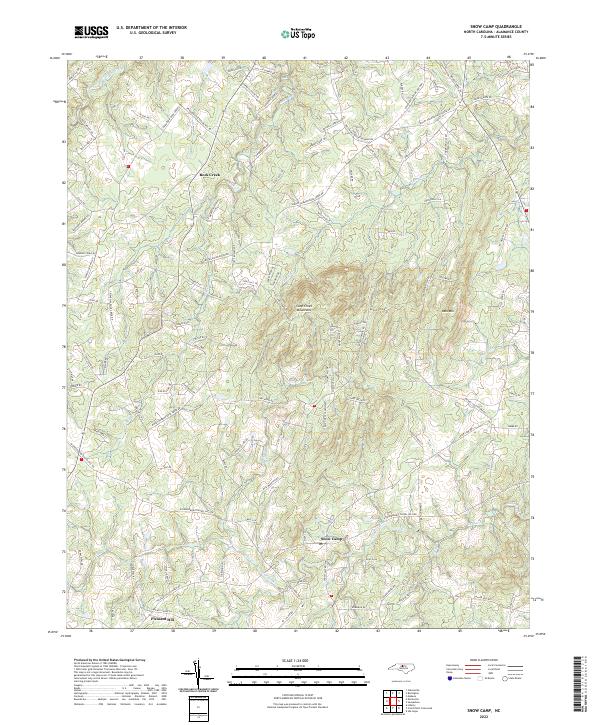
2022 Map of Snow Camp
USGS Topo · Published 2022About this map
Snow Camp and the surrounding Alamance County landscape are defined by the prominent Cane Creek Mountains and the winding course of Cane Creek. This 2022 survey captures a rural North Carolina terrain where long-standing settlement patterns are preserved in the road network and small communities like Rock Creek and Pleasant Hill. The topography is shaped by significant heights such as Bass Mtn, while the drainage basins of Stinking Quarter Cr and Vandals Cr dictate the local geography. Many of the thoroughfares, such as Coble Mill Rd and Pleasant Hill Church Rd, hint at the historic centers of community life and early industry that have anchored this region for generations. This map provides a contemporary view of a landscape where traditional agricultural roots and modern residential clusters intersect near Holt Crossroads.
Find a feature on this map
113 named features on this map. Tap any name to fly to it.
Don’t see what you’re looking for? This feature index may not catch every label — zoom into the map to look around manually.
Map Details
Editions of this 2022 Snow Camp Map
This is the sole edition of this map. No revisions or reprints were ever made.
Other maps of this area

1953 · Raleigh
USGS Topo · 1:250,000

1953 · Greensboro
USGS Topo · 1:250,000

1954 · Greensboro
USGS Topo · 1:250,000

1954 · Raleigh
USGS Topo · 1:250,000

1962 · Greensboro
USGS Topo · 1:250,000

1966 · Greensboro
USGS Topo · 1:250,000

1969 · Burlington
USGS Topo · 1:24,000

1969 · Mebane
USGS Topo · 1:24,000

1970 · Gibsonville
USGS Topo · 1:24,000

1970 · Kimesville
USGS Topo · 1:24,000