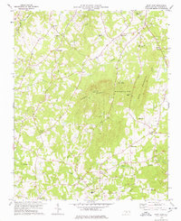
1978 Map of Snow Camp
USGS Topo · Published 1978About this map
Snow Camp anchors this Piedmont landscape, serving as a hub for a network of country roads and historical meeting houses in southern Alamance County. The terrain is defined by the prominent Cane Creek Mountains and Bass Mountain, which rise sharply above the drainages of Cane Creek and Rock Creek. This area was well-established by the late 1970s, evidenced by the dense placement of rural institutions such as Sylvan Sch, Cane Creek Ch, and Mt Hermon Ch. The landscape reveals a mix of traditional agriculture and local industry, with Quarries located near the eastern slopes and pipelines cutting across the southwestern quadrant. Smaller communities like Sutton and Smith are visible, while Camp Frontier occupies the wooded slopes between the major ridges.
Find a feature on this map
31 named features on this map. Tap any name to fly to it.
Don’t see what you’re looking for? This feature index may not catch every label — zoom into the map to look around manually.
Map Details
Editions of this 1978 Snow Camp Map
This is the sole edition of this map. No revisions or reprints were ever made.
Other maps of this area

1953 · Raleigh
USGS Topo · 1:250,000

1953 · Greensboro
USGS Topo · 1:250,000

1954 · Greensboro
USGS Topo · 1:250,000

1954 · Raleigh
USGS Topo · 1:250,000

1962 · Greensboro
USGS Topo · 1:250,000

1966 · Greensboro
USGS Topo · 1:250,000

1969 · Burlington
USGS Topo · 1:24,000

1969 · Mebane
USGS Topo · 1:24,000

1970 · Gibsonville
USGS Topo · 1:24,000

1970 · Kimesville
USGS Topo · 1:24,000