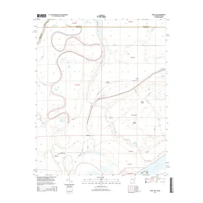
2014 Map of Snow Lake
USGS Topo · Published 2014About this map
Snow Lake and the surrounding river lowlands are defined by a complex network of meander scars and seasonal waterways at the junction of the Mississippi River and the White River. This landscape, shaped by the shifting courses of these great rivers, is dotted with namesake landmarks such as Henrico Bar and Tarblue Lakebed. The topography reveals a history of land management through drainage and access, where Scrubgrass Bayou and Deep Bayou wind through former lakebeds and across county lines. Small settlements like Mozart and Stimson provide points of human occupancy amidst the numerous oxbows, including Big Round Lake and Alligator Lake. For researchers, the presence of several family or community burial sites like Thompsons Cem and Gum Grove Cem offers clear genealogical waypoints within this hydraulic environment. The transition from active river channels to stabilized backwaters like Lake Defiance illustrates the ongoing evolution of the Arkansas delta.
Find a feature on this map
56 named features on this map. Tap any name to fly to it.
Don’t see what you’re looking for? This feature index may not catch every label — zoom into the map to look around manually.
Map Details
Editions of this 2014 Snow Lake Map
This is the sole edition of this map. No revisions or reprints were ever made.
Other maps of this area

1930 · Mellwood
USGS Topo · 1:62,500

1939 · Henrico
USGS Topo · 1:62,500

1939 · Pace
USGS Topo · 1:62,500

1939 · Big Island
USGS Topo · 1:62,500

1939 · Mellwood
USGS Topo · 1:62,500

1948 · Helena
USGS Topo · 1:250,000

1950 · Helena
USGS Topo · 1:250,000

1953 · Greenwood
USGS Topo · 1:250,000

1954 · Mellwood
USGS Topo · 1:62,500

1954 · Henrico
USGS Topo · 1:62,500