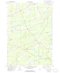
1982 Map of Snow Mountain
USGS Topo · Published 1991About this map
Souadabscook Stream and its tributaries carve through the rolling woodlots and small agricultural clearings of Penobscot and Waldo counties in the late 1970s and early 1980s. The landscape is defined by its rural intersections and traditional crossroad settlements, such as Ellingwood Corner and Whites Corner, which served as local hubs for the surrounding farmsteads. Family history is etched into the terrain through landmarks like Fred Low Hill and Pickard Hill, while numerous small burial grounds, including Chapman Cem and Twining Cem, remain scattered across the countryside.
Find a feature on this map
54 named features on this map. Tap any name to fly to it.
Don’t see what you’re looking for? This feature index may not catch every label — zoom into the map to look around manually.
Map Details
Editions of this 1982 Snow Mountain Map
2 editions found
Other maps of this area

1900 · Bucksport
USGS Topo · 1:62,500

1902 · Bucksport
USGS Topo · 1:62,500

1902 · Bangor
USGS Topo · 1:62,500

1931 · Stetson
USGS Topo · 1:48,000

1932 · Brooks
USGS Topo · 1:62,500

1935 · Stetson
USGS Topo · 1:62,500

1942 · Bangor
USGS Topo · 1:62,500

1942 · Bucksport
USGS Topo · 1:62,500

1946 · Bangor
USGS Topo · 1:62,500

1948 · Bangor
USGS Topo · 1:250,000