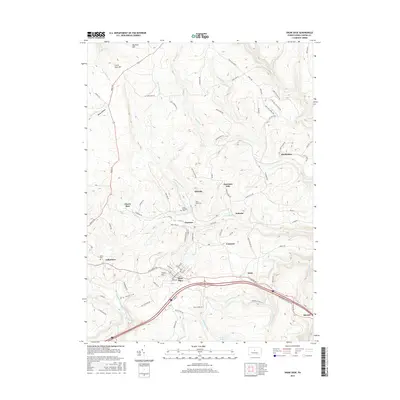
2016 Map of Snow Shoe
USGS Topo · Published 2016About this map
The mountain settlements of Snow Shoe and Clarence define this 2016 landscape in Centre County, revealing a complex network of local roads and watercourses. The layout of the region is punctuated by distinct neighborhood divisions such as Poorman Side, Old Side, and the nearby hamlet of Gillintown. Genealogists will find significant value in the documentation of local burial grounds, including Saint Marys Cem, Saint Michaels Cem, and Askey Cem, which are situated amidst the rugged topography of the Allegheny Front. The map traces the drainage of the Beech Creek watershed, featuring the N Fork Beech Cr and S Fork Beech Cr, along with the Snow Shoe Reservoir. To the north, the terrain rises toward Big Fork Hill and Little Fork Hill, where a labyrinth of logging and access roads like Wolf Run Supply and Little Wolf Run Ridge Rd crisscross the high ridges and hollows.
Find a feature on this map
91 named features on this map. Tap any name to fly to it.
Don’t see what you’re looking for? This feature index may not catch every label — zoom into the map to look around manually.
Map Details
Editions of this 2016 Snow Shoe Map
This is the sole edition of this map. No revisions or reprints were ever made.
Other maps of this area

1908 · Bellefonte
USGS Topo · 1:62,500

1909 · Bellefonte
USGS Topo · 1:62,500

1922 · Philipsburg
USGS Topo · 1:62,500

1928 · Snow Shoe
USGS Topo · 1:48,000

1929 · Karthaus
USGS Topo · 1:62,500

1931 · Show Shoe
USGS Topo · 1:62,500

1932 · Karthaus
USGS Topo · 1:62,500

1939 · Philipsburg
USGS Topo · 1:62,500

1943 · Lewistown
USGS Topo · 1:125,000

1945 · Philipsburg
USGS Topo · 1:62,500