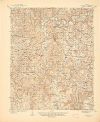
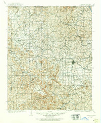
1941 Map of Snowball
USGS Topo · Published 1941About this map
The Buffalo River snakes through the northern reaches of this Ozark landscape, defining a region of tight hollows and high knobs at the transition between Newton and Searcy counties. The map captures a pre-war upland economy centered on small, dispersed communities like Snowball and Witt Springs, where life revolved around a network of rural institutions. This is evidenced by the high density of neighborhood-scale schoolhouses, including the Welcome Home Sch and Bohannon Sch, many of which were the primary landmarks for these isolated valleys.
Find a feature on this map
162 named features on this map. Tap any name to fly to it.
Don’t see what you’re looking for? This feature index may not catch every label — zoom into the map to look around manually.
Map Details
Editions of this 1941 Snowball Map
This is the sole edition of this map. No revisions or reprints were ever made.
Other maps of this area
1879 · Washington
USGS Topo · 1:62,500
1887 · Smyrna
USGS Topo · 1:62,500
1889 · Treat
USGS Topo · 1:62,500
1889 · Marshall #3
USGS Topo · 1:62,500

1892 · Marshall
USGS Topo · 1:125,000

1893 · Yellville
USGS Topo · 1:125,000
1894 · Marshall
USGS Topo · 1:125,000
1901 · Marshall
USGS Topo · 1:125,000
1903 · Yellville
USGS Topo · 1:125,000
1904 · Harrison
USGS Topo · 1:125,000