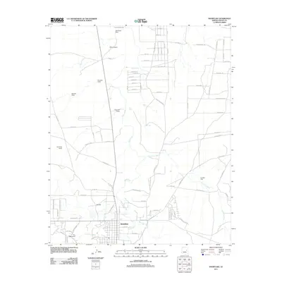
2011 Map of Snowflake
USGS Topo · Published 2011About this map
Snowflake serves as the central hub of this Navajo County landscape, where the grid of the town site meets the winding course of Silver Creek. The high desert terrain is defined by a series of drainage systems, including Sevenmile Draw, Fivemile Draw, and Fourmile Draw, which feed into the primary creek valley. To the east, the vast Concho Flat and the drainage of Concho Flat Wash illustrate the open grazing lands and ranching heritage of the region. Evidence of water management for this arid climate is visible in The Canal and various reservoirs like Riley Tank and Lower Tank. Distinctive geological landmarks such as Point Lookout, Red Hill, and Pin Head Knoll provide vertical relief against the plateau. The map also reveals an extensive network of ranch roads and trails, including Willis Ranch Rd and Rocking R Ranch Trl, tracing the movement of people and livestock across the northern Arizona steppe.
Find a feature on this map
90 named features on this map. Tap any name to fly to it.
Don’t see what you’re looking for? This feature index may not catch every label — zoom into the map to look around manually.
Map Details
Editions of this 2011 Snowflake Map
This is the sole edition of this map. No revisions or reprints were ever made.
Other maps of this area

1886 · St Johns
USGS Topo · 1:250,000

1886 · Holbrook
USGS Topo · 1:250,000

1892 · St Johns
USGS Topo · 1:250,000

1893 · Holbrook
USGS Topo · 1:250,000

1954 · Holbrook
USGS Topo · 1:250,000

1954 · Saint Johns
USGS Topo · 1:250,000

1957 · Holbrook
USGS Topo · 1:250,000

1957 · Saint Johns
USGS Topo · 1:250,000

1958 · Saint Johns
USGS Topo · 1:250,000

1958 · Holbrook
USGS Topo · 1:250,000