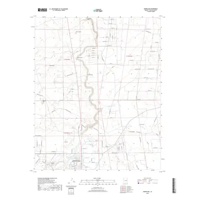
2018 Map of Snowflake
USGS Topo · Published 2018About this map
Snowflake sits at the heart of this Navajo County landscape, defined by a sophisticated system of water management essential for high-desert life. The map reveals the intricate path of The Canal and the E Snowflake Ditch, which divert water from Silver Cr to support the local community. The terrain is marked by a series of sequential landmarks, from Fourmile Knoll and Fivemile Draw to Sixmile Draw, suggesting an era of overland travel where distance was measured by these distinctive natural features. To the east, the broad expanse of Concho Flat and the elevations of Pin Head Knoll and Point Lookout overlook a network of ranch roads and trails, including Star Ranch Trl and Rockin R Ranch Rd, illustrating the continued importance of the ranching economy in the region.
Find a feature on this map
102 named features on this map. Tap any name to fly to it.
Don’t see what you’re looking for? This feature index may not catch every label — zoom into the map to look around manually.
Map Details
Editions of this 2018 Snowflake Map
This is the sole edition of this map. No revisions or reprints were ever made.
Other maps of this area

1886 · St Johns
USGS Topo · 1:250,000

1886 · Holbrook
USGS Topo · 1:250,000

1892 · St Johns
USGS Topo · 1:250,000

1893 · Holbrook
USGS Topo · 1:250,000

1954 · Holbrook
USGS Topo · 1:250,000

1954 · Saint Johns
USGS Topo · 1:250,000

1957 · Holbrook
USGS Topo · 1:250,000

1957 · Saint Johns
USGS Topo · 1:250,000

1958 · Saint Johns
USGS Topo · 1:250,000

1958 · Holbrook
USGS Topo · 1:250,000