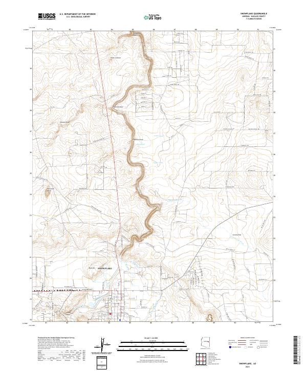
2021 Map of Snowflake
USGS Topo · Published 2021About this map
Snowflake sits at the heart of this Arizona landscape, positioned along the banks of Silver Creek where a network of irrigation works, including The Canal and the E Snowflake Ditch, supported local agriculture. The terrain is defined by a series of prominent volcanic or erosional features such as Red Hill, Pin Head Knoll, and Fourmile Knoll, which rise above the surrounding washes and flats. These landmarks provided natural orientation points for early settlers and ranchers across Concho Flat.
Find a feature on this map
119 named features on this map. Tap any name to fly to it.
Don’t see what you’re looking for? This feature index may not catch every label — zoom into the map to look around manually.
Map Details
Editions of this 2021 Snowflake Map
This is the sole edition of this map. No revisions or reprints were ever made.
Other maps of this area

1886 · St Johns
USGS Topo · 1:250,000

1886 · Holbrook
USGS Topo · 1:250,000

1892 · St Johns
USGS Topo · 1:250,000

1893 · Holbrook
USGS Topo · 1:250,000

1954 · Holbrook
USGS Topo · 1:250,000

1954 · Saint Johns
USGS Topo · 1:250,000

1957 · Holbrook
USGS Topo · 1:250,000

1957 · Saint Johns
USGS Topo · 1:250,000

1958 · Saint Johns
USGS Topo · 1:250,000

1958 · Holbrook
USGS Topo · 1:250,000