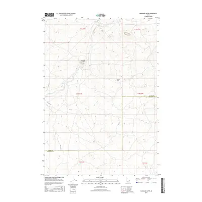
2017 Map of Snowshoe Butte
USGS Topo · Published 2017About this map
The high volcanic plateau of eastern Idaho dominates this area, where the boundaries of Clark County and Fremont County meet across a landscape of ancient ridges and seasonal watercourses. The most prominent hydrologic feature is Camas Creek, which winds through the northern sections of the map, carving a path through the basaltic terrain typical of the Snake River Plain’s northern fringes. While the region lacks permanent settlements, the map reveals a network of local roads and trails, such as Gravy Ridge Road and Jacoby Road, which facilitate access for ranching and recreation in this corner of the High Desert.
Find a feature on this map
1 named feature on this map. Tap any name to fly to it.
Don’t see what you’re looking for? This feature index may not catch every label — zoom into the map to look around manually.
Map Details
Editions of this 2017 Snowshoe Butte Map
This is the sole edition of this map. No revisions or reprints were ever made.
Other maps of this area

1955 · Dubois
USGS Topo · 1:250,000

1955 · Ashton
USGS Topo · 1:250,000

1958 · Dubois
USGS Topo · 1:250,000

1958 · Ashton
USGS Topo · 1:250,000

1960 · Ashton
USGS Topo · 1:250,000

1964 · Dubois NE
USGS Topo · 1:24,000
1964 · Dubois SE
USGS Topo · 1:24,000

1972 · Pine Butte
USGS Topo · 1:24,000
1972 · Split Rock
USGS Topo · 1:24,000
1972 · Snowshoe Butte
USGS Topo · 1:24,000