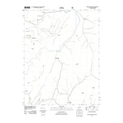
2011 Map of Snowy Mountain
USGS Topo · Published 2011About this map
Hardscrabble and Blue Grass anchor this 2011 survey of the high ridges and steep valleys along the West Virginia and Virginia border. The landscape is defined by the North Fork South Branch Potomac River, which snakes through a narrow corridor between River Hill and the massive bulk of Snowy Mountain. This region is characterized by named ridges and peaks like Devils Backbone and Middle Mountain, where remote settlements followed the logic of the terrain, settling in "hollows" and "flats" such as White Oak Flat. Genealogists and local historians can locate the Blue Grass Cemetery and trace the complex network of mountain streams, including Straight Fork and Teeter Camp Run, which shaped the early development and movement of families through these Appalachians. The map clearly shows the transition from West Virginia's County Hwy 17 into Virginia's road system near the southern edge.
Find a feature on this map
43 named features on this map. Tap any name to fly to it.
Don’t see what you’re looking for? This feature index may not catch every label — zoom into the map to look around manually.
Map Details
Editions of this 2011 Snowy Mountain Map
This is the sole edition of this map. No revisions or reprints were ever made.
Other maps of this area

1889 · Beverly
USGS Topo · 1:125,000

1892 · Beverly
USGS Topo · 1:125,000

1892 · Franklin
USGS Topo · 1:125,000

1894 · Staunton
USGS Topo · 1:125,000

1896 · Franklin
USGS Topo · 1:125,000

1901 · Monterey
USGS Topo · 1:125,000

1922 · Spruce Knob
USGS Topo · 1:48,000

1922 · Circleville
USGS Topo · 1:62,500

1924 · Circleville
USGS Topo · 1:48,000

1924 · Mc Dowell
USGS Topo · 1:62,500