
1926 Map of Snyder 1-a
USGS Topo · Published 1926About this map
The Double Mountain Fork Brazos River carves a winding path through this West Texas landscape, where the borders of Kent, Stonewall, and Fisher counties meet. Surveyed in 1926 by T.F. Murphy, the terrain is defined by a dense network of erosional features such as Adair Canyon and Tiger Canyon, which reveal the complex drainage patterns of the Brazos watershed before large-scale modernization. The presence of the County Line School and the Canadian Highway points to a rural infrastructure supporting scattered communities in the Longhorn Valley. This map represents an early application of aerial photography by the Air Corps, U.S. Army, to supplement traditional ground topography, capturing the fine details of local landmarks like Rough Creek and Poteet Canyon.
Find a feature on this map
16 named features on this map. Tap any name to fly to it.
Don’t see what you’re looking for? This feature index may not catch every label — zoom into the map to look around manually.
Map Details
Editions of this 1926 Snyder 1-a Map
This is the sole edition of this map. No revisions or reprints were ever made.
Other maps of this area

1893 · Roby
USGS Topo · 1:125,000

1926 · Roby 2-b
USGS Topo · 1:48,000

1931 · Rotan
USGS Topo · 1:62,500

1932 · Camp Springs
USGS Topo · 1:62,500

1954 · Lubbock
USGS Topo · 1:250,000

1954 · Big Spring
USGS Topo · 1:250,000

1958 · Big Spring
USGS Topo · 1:250,000

1968 · Double Mountains
USGS Topo · 1:24,000
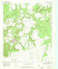
1969 · White Canyon
USGS Topo · 1:24,000

1969 · Camp Springs
USGS Topo · 1:24,000