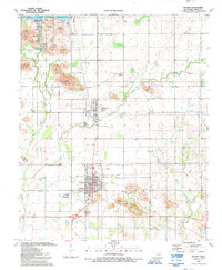
1991 Map of Snyder
USGS Topo · Published 1992About this map
Snyder and the neighboring community of Mountain Park anchor this southwestern Oklahoma landscape during the early 1990s. The infrastructure of the era is clearly defined by the Tom Steed Reservoir and the adjacent Great Plains State Park, which dominate the northern portion of the quadrangle. Local civic and spiritual life is recorded through features like the High Sch, Southside Ch, and Primitive Ch, while the industrial character of the region is evidenced by several Quarries and Gravel Pits.
Find a feature on this map
31 named features on this map. Tap any name to fly to it.
Don’t see what you’re looking for? This feature index may not catch every label — zoom into the map to look around manually.
Map Details
Editions of this 1991 Snyder Map
This is the sole edition of this map. No revisions or reprints were ever made.
Other maps of this area

1949 · Cooperton
USGS Topo · 1:62,500

1950 · Snyder
USGS Topo · 1:62,500

1955 · Lawton
USGS Topo · 1:250,000

1956 · Glen Mountains
USGS Topo · 1:24,000

1956 · Cooperton
USGS Topo · 1:24,000

1956 · Odetta
USGS Topo · 1:24,000

1956 · Manitou
USGS Topo · 1:24,000

1956 · Snyder
USGS Topo · 1:24,000

1956 · Indiahoma
USGS Topo · 1:24,000

1956 · Snyder
USGS Topo · 1:62,500