
1956 Map of Indiahoma
USGS Topo · Published 1959About this map
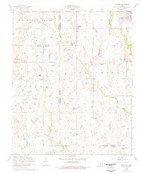
Indiahoma serves as the primary hub in this mid-century Oklahoma landscape, where the confluence of several prominent watercourses defines the local geography. The intricate drainage network includes Little Oak Creek, Little Post Oak Creek, and Sandy Creek, which carve through the terrain of Mountain Park and Hunter. This survey reveals a community deeply rooted in its local institutions, evidenced by the distribution of rural landmarks such as the Post Oak Mission School and the Indiahoma IOOF Cemetery.
Find a feature on this map
21 named features on this map. Tap any name to fly to it.
Don’t see what you’re looking for? This feature index may not catch every label — zoom into the map to look around manually.
Map Details
Editions of this 1956 Indiahoma Map
2 editions found
Other maps of this area

1937 · Cache
USGS Topo · 1:48,000

1937 · Quanah Mountain
USGS Topo · 1:24,000

1942 · Cache
USGS Topo · 1:62,500

1949 · Quanah Mountain
USGS Topo · 1:24,000

1950 · Snyder
USGS Topo · 1:62,500

1955 · Lawton
USGS Topo · 1:250,000

1956 · Post Oak Creek
USGS Topo · 1:24,000

1956 · Odetta
USGS Topo · 1:24,000
1956 · Quanah Mountain
USGS Topo · 1:24,000

1956 · Manitou
USGS Topo · 1:24,000