
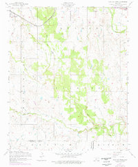
1956 Map of Post Oak Creek
USGS Topo · Published 1959About this map
The Oklahoma prairie between Indiahoma and Cache is defined by the winding course of Post Oak Creek and its tributaries during the mid-1950s. This survey by the Corps of Engineers and the Geological Survey documents the rural transition from the high ground of Quanah and Painter toward the lowland drainage of West Cache Creek. The landscape is bisected by the St Louis - San Francisco railroad line, which served as a vital transport corridor for these southwestern Oklahoma communities.
Find a feature on this map
15 named features on this map. Tap any name to fly to it.
Don’t see what you’re looking for? This feature index may not catch every label — zoom into the map to look around manually.
Map Details
Editions of this 1956 Post Oak Creek Map
2 editions found
Other maps of this area

1937 · Cache
USGS Topo · 1:48,000

1937 · Quanah Mountain
USGS Topo · 1:24,000

1942 · Cache
USGS Topo · 1:62,500

1949 · Mount Scott
USGS Topo · 1:24,000

1949 · Quanah Mountain
USGS Topo · 1:24,000

1950 · Snyder
USGS Topo · 1:62,500

1955 · Lawton
USGS Topo · 1:250,000

1956 · Odetta
USGS Topo · 1:24,000
1956 · Quanah Mountain
USGS Topo · 1:24,000
1956 · Mount Scott
USGS Topo · 1:24,000