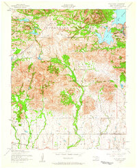
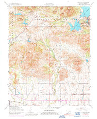
1956 Map of Mount Scott
USGS Topo · Published 1959About this map
Wichita Mountains Wildlife Refuge and the Fort Sill Military Reservation dominate this mid-century landscape, illustrating the intersection of federal conservation and military presence in Oklahoma. The map documents the recreational and spiritual centers of the era, notably the Holy City Church and the site of the Easter Pageant near Mount Roosevelt. Water management is a central theme, with Lake Lawtonka and Elmer Thomas Lake serving as significant landmarks alongside smaller bodies like Lake Jed Johnson and Lake Rush.
Find a feature on this map
62 named features on this map. Tap any name to fly to it.
Don’t see what you’re looking for? This feature index may not catch every label — zoom into the map to look around manually.
Map Details
Editions of this 1956 Mount Scott Map
5 editions found
Other maps of this area

1937 · Cache
USGS Topo · 1:48,000

1937 · Quanah Mountain
USGS Topo · 1:24,000

1942 · Cache
USGS Topo · 1:62,500

1946 · Lawton
USGS Topo · 1:62,500

1949 · Mount Scott
USGS Topo · 1:24,000

1949 · Quanah Mountain
USGS Topo · 1:24,000

1949 · Fort Sill
USGS Topo · 1:24,000

1950 · Saddle Mountain
USGS Topo · 1:62,500

1955 · Lawton
USGS Topo · 1:250,000

1956 · Post Oak Creek
USGS Topo · 1:24,000