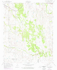
1956 Map of Post Oak Creek
USGS Topo · Published 1976About this map
Indiahoma and the surrounding prairie of Comanche County are captured in this mid-century survey, which reveals the rural landscape just south of the Wichita Mountains. The settlement of Indiahoma sits in the northwest, oriented along the St Louis - San Francisco railroad line, a vital transportation corridor for the region's agricultural economy. Further east, the town of Cache borders the edge of Wichita Park, providing a window into the development of local communities along the boundary of protected lands.
Find a feature on this map
16 named features on this map. Tap any name to fly to it.
Don’t see what you’re looking for? This feature index may not catch every label — zoom into the map to look around manually.
Map Details
Editions of this 1956 Post Oak Creek Map
2 editions found
Other maps of this area

1937 · Cache
USGS Topo · 1:48,000

1937 · Quanah Mountain
USGS Topo · 1:24,000

1942 · Cache
USGS Topo · 1:62,500

1949 · Mount Scott
USGS Topo · 1:24,000

1949 · Quanah Mountain
USGS Topo · 1:24,000

1950 · Snyder
USGS Topo · 1:62,500

1955 · Lawton
USGS Topo · 1:250,000

1956 · Post Oak Creek
USGS Topo · 1:24,000

1956 · Odetta
USGS Topo · 1:24,000
1956 · Quanah Mountain
USGS Topo · 1:24,000