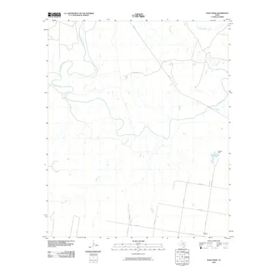
2010 Map of Soap Creek
USGS Topo · Published 2010About this map
Soap Creek and the Wichita River converge in a landscape defined by seasonal watercourses and rural ranch roads in this section of north-central Texas. The topography is shaped by the drainage patterns of the North Wichita River and the meandering path of Crooked Creek as they move toward the main river channel. Human infrastructure is concentrated along the southern and eastern margins of the sheet, marked by several county roads such as Co RD 140 and Arledge Rd that navigate the varied elevation.
Find a feature on this map
19 named features on this map. Tap any name to fly to it.
Don’t see what you’re looking for? This feature index may not catch every label — zoom into the map to look around manually.
Map Details
Editions of this 2010 Soap Creek Map
This is the sole edition of this map. No revisions or reprints were ever made.
Other maps of this area

1954 · Wichita Falls
USGS Topo · 1:250,000

1958 · Wichita Falls
USGS Topo · 1:250,000

1966 · Seymour West
USGS Topo · 1:24,000

1966 · Santa Rosa Lake SW
USGS Topo · 1:24,000

1966 · Soap Creek
USGS Topo · 1:24,000

1966 · Colwell Creek
USGS Topo · 1:24,000

1966 · Bomarton
USGS Topo · 1:24,000

1966 · Vera
USGS Topo · 1:24,000

1966 · Northwest Lake Kemp
USGS Topo · 1:24,000

1966 · Southwest Lake Kemp
USGS Topo · 1:24,000