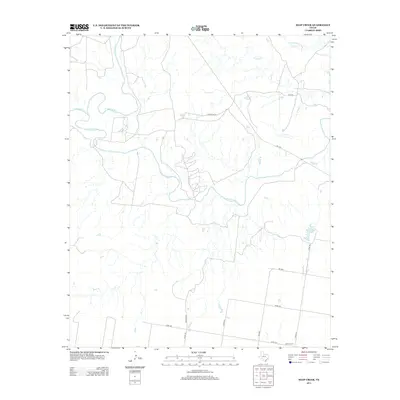
2013 Map of Soap Creek
USGS Topo · Published 2013About this map
The Wichita River meanders across this rural expanse of Knox County, where the convergence of the N Wichita River and S Wichita River defines the local drainage pattern. This landscape is a patchwork of ranch roads and remote watercourses, including the winding Soap Cr and Crooked Cr. The map captures a primarily agricultural region structured by a grid of rural routes such as Arledge Rd and Self Rd, reflecting the long-standing land divisions of North Texas.
Find a feature on this map
18 named features on this map. Tap any name to fly to it.
Don’t see what you’re looking for? This feature index may not catch every label — zoom into the map to look around manually.
Map Details
Editions of this 2013 Soap Creek Map
This is the sole edition of this map. No revisions or reprints were ever made.
Other maps of this area

1954 · Wichita Falls
USGS Topo · 1:250,000

1958 · Wichita Falls
USGS Topo · 1:250,000

1966 · Seymour West
USGS Topo · 1:24,000

1966 · Santa Rosa Lake SW
USGS Topo · 1:24,000

1966 · Soap Creek
USGS Topo · 1:24,000

1966 · Colwell Creek
USGS Topo · 1:24,000

1966 · Bomarton
USGS Topo · 1:24,000

1966 · Vera
USGS Topo · 1:24,000

1966 · Northwest Lake Kemp
USGS Topo · 1:24,000

1966 · Southwest Lake Kemp
USGS Topo · 1:24,000