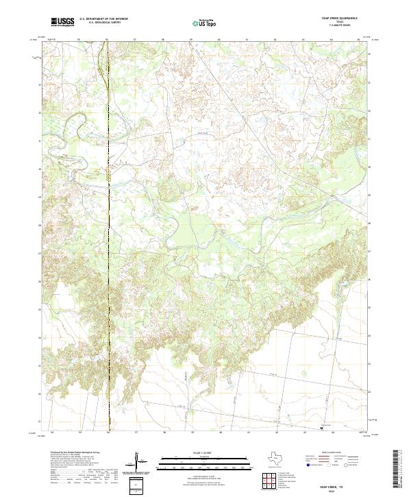
2022 Map of Soap Creek
USGS Topo · Published 2022About this map
The confluence of the North Wichita River and South Wichita River forms the main stem of the Wichita River at the intersection of Baylor, Knox, and Foard counties. This landscape is defined by the hydrologic movement of these waterways and their smaller tributaries like Soap Cr and Crooked Cr. While much of the land remains open, human presence is traced through a grid of rural roads and specific landmarks like Peacock Lake. To the south, the solitary Hanson Cem provides a point of genealogical interest along Co Rd 140, serving as a silent anchor for family history in this cattle and ranching region of North Texas. The map illustrates how transportation routes like FM 1919 and FM 2069 navigate the breaks and drainage basins of the river system.
Find a feature on this map
21 named features on this map. Tap any name to fly to it.
Don’t see what you’re looking for? This feature index may not catch every label — zoom into the map to look around manually.
Map Details
Editions of this 2022 Soap Creek Map
This is the sole edition of this map. No revisions or reprints were ever made.
Other maps of this area

1954 · Wichita Falls
USGS Topo · 1:250,000

1958 · Wichita Falls
USGS Topo · 1:250,000

1966 · Seymour West
USGS Topo · 1:24,000

1966 · Santa Rosa Lake SW
USGS Topo · 1:24,000

1966 · Soap Creek
USGS Topo · 1:24,000

1966 · Colwell Creek
USGS Topo · 1:24,000

1966 · Bomarton
USGS Topo · 1:24,000

1966 · Vera
USGS Topo · 1:24,000

1966 · Northwest Lake Kemp
USGS Topo · 1:24,000

1966 · Southwest Lake Kemp
USGS Topo · 1:24,000