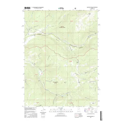
2017 Map of Soapstone Basin
USGS Topo · Published 2017About this map
Wasatch National Forest and Uinta National Forest meet in this high-elevation mountain terrain where the headwaters of the Provo River and its various forks dominate the landscape. The geography is defined by a network of steep drainages including Log Hollow, Lambert Hollow, and Campbell Hollow, providing a clear look at the drainage patterns into the N Fork Provo River and S Fork Provo River. Civil engineering is represented by the West Portal Duchesne Tunnel, highlighting the region's historical and ongoing importance for water management.
Find a feature on this map
42 named features on this map. Tap any name to fly to it.
Don’t see what you’re looking for? This feature index may not catch every label — zoom into the map to look around manually.
Map Details
Editions of this 2017 Soapstone Basin Map
This is the sole edition of this map. No revisions or reprints were ever made.
Other maps of this area

1885 · Salt Lake
USGS Topo · 1:250,000

1885 · Uinta
USGS Topo · 1:250,000

1900 · Coalville
USGS Topo · 1:125,000

1901 · Hayden Peak
USGS Topo · 1:125,000

1903 · Hayden Peak
USGS Topo · 1:125,000

1903 · Coalville
USGS Topo · 1:125,000

1907 · Strawberry Valley
USGS Topo · 1:125,000

1909 · Strawberry Valley
USGS Topo · 1:125,000

1954 · Salt Lake City
USGS Topo · 1:250,000

1958 · Salt Lake City
USGS Topo · 1:250,000